
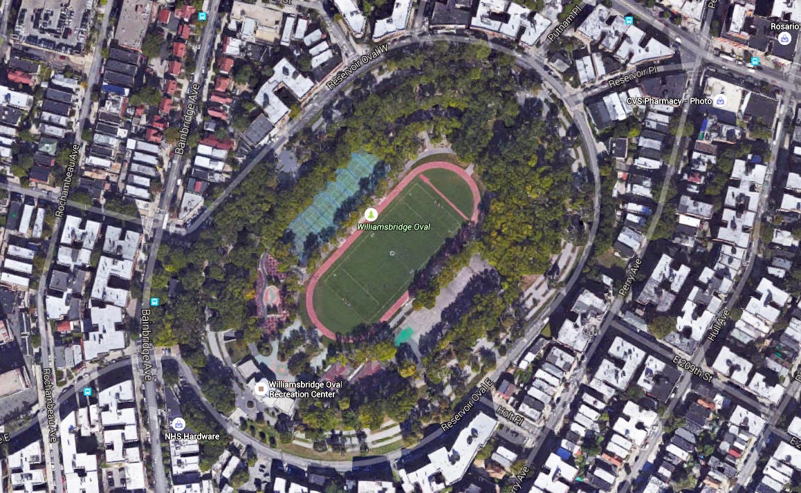
Oval Park, also known as Williamsbridge Oval, in
the Bronx; image: Google Maps. The road that goes around the circumfrence
of the park is Reservoir Oval West (top and left) and Reservoir Oval East
(bottom and right) (see map). Until 1934
this was the site of an old reservoir[1,2]. From
1934 to 1937 the WPA transformed it into a park full of playgrounds,
athletic fields, and game courts. The massive construction project left the
road in need of reconstruction, and this was done at some point near the end
of the project.
References:
- Williamsbridge Oval Park, Kermit Project website.
- Williamsbridge Oval Historical Photos, Kermit Project website.
- Reservoir Oval Resurfacing - Bronx NY, Living New Deal (Evan Kalish): National Archives RG 69: Records of the Work Projects Administration [WPA]; Project Files; New York City (E 407); box 684; roll 3642.
|
The New Deal in
NYC 1932-1943 |
Frank da Cruz |
fdc@columbia.edu
|